
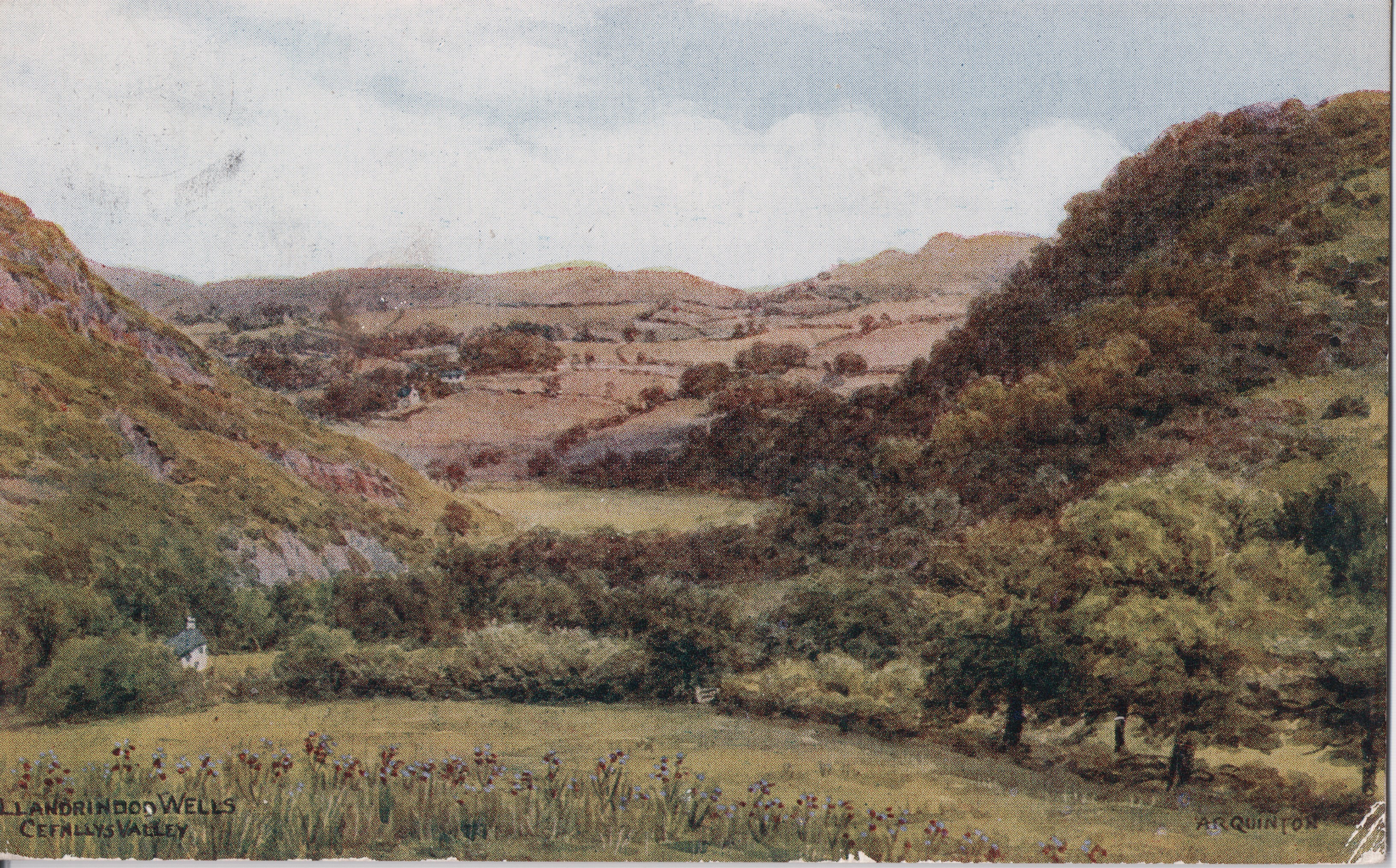
There are places whose history survives principally in buildings, and others where it survives in the landscape. Llandrindod Wells has both. The great hotels, the railway station, the Pavilion and the surviving commercial buildings still tell much of the story of the Victorian and Edwardian spa, but another part of that world once lay beyond the streets, along lanes, across fields, beside the River Ithon and over the wooded hills surrounding the town. For generations of visitors, walking was not simply something to do when there was nothing else happening. It was part of the experience of coming to Llandrindod Wells, as familiar to the holiday as taking the waters, eating in the hotels or attending an evening concert.
Visitors came for the mineral springs, stayed in hotels and boarding houses, shopped, attended entertainments, played bowls and golf, and filled the hours between meals and treatment by exploring the surrounding countryside. Lovers’ Leap, Cefnllys, Shaky Bridge and Alpine Bridge became familiar names in guidebooks, newspapers and postcards, while other walks led towards Little Hill, Bailey Einon, Pantpurlais, Llanyre, Disserth, Llanbadarn, Castell Collen, the old lead workings and farther into Radnorshire. Some were short enough for an evening stroll, others occupied much of an afternoon, and by the Edwardian period cycling was extending the same recreational landscape towards Builth Wells, Rhayader and the Elan Valley.
What is striking today is not that these places disappeared, because many of them did not. Cefnllys remains, the Ithon still winds beneath Castle Hill, Lovers’ Leap is still part of the landscape around Rock Park, and the name Shaky Bridge has survived long after the bridge which made it famous. What disappeared was the culture which connected them. The old walks belonged to a particular kind of holiday and a particular way of experiencing Llandrindod Wells, one in which the countryside immediately beyond the town could provide an afternoon’s entertainment in its own right.
Before the railway
The walking culture of Llandrindod did not begin with the railway. Long before the Victorian town appeared, visitors coming to take the waters were already moving through the surrounding countryside on foot. An account of travel through the district in the early nineteenth century recommended a shorter and particularly beautiful route for pedestrians across the meadows between Llandrindod and Rhayader, while T. J. Llewelyn Prichard’s The Cambrian Balnea, published in 1825, described the countryside around Llandrindod at a time when the modern town did not yet exist and drew attention to a particularly picturesque crossing of the Ithon near Llanbadarn Fawr.
Prichard called it “a very picturesque alpine bridge called Pont-y-Graig” and noted that visitors from Llandrindod frequently went there to see it and make sketches. That single description takes the recreational history of Alpine Bridge back much farther than the later Victorian spa. Pont-y-Graig was already a recognised excursion before the railway, before the great hotels and before the streets of modern Llandrindod were laid out. Visitors were not merely passing over the bridge on the way somewhere else. They went specifically to look at the place, admire the scenery and draw it, which places the crossing firmly within the older culture of the Picturesque.
The word “alpine” also tells us something about how visitors understood the landscape. Prichard used similar language elsewhere for rough timber crossings in dramatic Welsh scenery. In that period an “alpine bridge” did not necessarily mean anything grand or engineered. It could mean little more than planks or timber thrown across a rocky stream, made picturesque by the setting around it. Pont-y-Graig therefore seems to have acquired its more romantic visitor name from the aesthetic language of the period rather than from any elaborate construction. The railway did not create this landscape of excursions from nothing. What it did was make it accessible to many more people and allow a much larger visitor economy to grow around it.
A spa made for walking
When the Central Wales Railway reached Llandrindod in 1865, the scale of the resort changed dramatically. People who had previously faced a difficult journey by road could now travel directly into central Radnorshire, and the growing spa began to attract visitors from South Wales, the Midlands, north-west England and farther afield. The arrival of the railway coincided with the division and development of the old common, so that the new town and the old rural landscape began to exist side by side.
Walking fitted naturally into the life of the spa. Taking the waters was rarely a matter of drinking a single glass and returning home. Visitors might remain for weeks, and their days were structured around mineral waters, meals, treatment, rest, exercise and social activity. The countryside surrounding Llandrindod therefore became part of what the resort had to sell. A walk was exercise, diversion, scenery and, to some extent, part of the therapeutic regime itself.
By August 1873 advertisements were already presenting the landscape in exactly this way. The park was recommended as a pleasant promenade, Lovers’ Leap as a cool and shady resort in warm weather, and excursions were advertised from the Pump House and Rock House Hotels to places including Cefnllys Castle and Alpine Bridge. A local guide could be bought at the post office for sixpence, while boating, fishing, archery, croquet, quoits and other amusements broadened the range of activities available to visitors. The growing town was learning very quickly that a successful resort needed to occupy people as well as treat them, and the old walks became part of that wider leisure economy.
Lovers’ Leap before the legend
One of the earliest named beauty spots was Lovers’ Leap. When members of the Woolhope Naturalists’ Field Club visited Llandrindod in June 1867 they walked from the Rock House Hotel towards the wooded bank above the Ithon and identified the place by that name. Their account contains a particularly revealing remark, suggesting that Lovers’ Leap apparently “wants a legend”. The observation is brief, but it matters because it implies that the name already existed while the familiar story of doomed lovers was either unknown to the writer or had not yet become firmly attached to the place.
Two years later the name appeared again under much sadder circumstances. In August 1869 twenty-two-year-old Pryce Davies, a medical student at Aberdeen and son of Edward Davies of Trefeen, Kerry, came to Llandrindod with members of his family and a fellow student. They stayed at the Llanarch Hotel and, on the morning of Saturday 28 August, Davies and two companions went to bathe in the River Ithon. The pool, a little below the Rock Hotel, was already known as Lovers’ Leap.
The inquest evidence gives an unusually detailed description of what happened. The pool was about fifteen yards across and deep enough to make rescue difficult. Davies was not a strong swimmer and got into trouble. His companion Nathaniel Lawrence repeatedly tried to reach him, but Davies drowned and Lawrence himself came close to exhaustion. Another report described Lovers’ Leap as one of the deepest pools in the upper Ithon and added that it had already been fatal to others. A warning board was recommended.
The incident is important for more than the tragedy itself. Davies had taken saline and chalybeate waters that morning before going to the river. His day followed the ordinary pattern of a Victorian visitor to Llandrindod: hotel accommodation, the waters, then recreation in the surrounding countryside. Lovers’ Leap was therefore not some remote feature detached from the resort. It formed part of the same landscape through which visitors moved every day.
How the legend developed
The origins of the name Lovers’ Leap remain uncertain, but by 1890 the story attached to it had changed considerably. A remarkable article in The Cambrian of 6 June 1890, headed “A Phantom Wedding at the Dead of Night: The Ghostly Lovers of Llandrindod”, described a group of visitors staying at a boarding house in High Street. After spending the evening discussing local sights, including Cefnllys, Castell Collen, Lovers’ Leap and Shaky Bridge, the writer claimed to witness mysterious lights and figures around Christ Church after midnight.
The story was deliberately humorous, but the discussion which followed is historically useful. A servant named Margaret suggested that the supposed ghosts might be the two sweethearts who had lost their lives after jumping together from Lovers’ Leap. She said that she had heard how they were drowned. There is no reason to treat the ghost story as fact, and still less reason to assume that it records a genuine double tragedy, but it does establish that by 1890 the story of two lovers jumping together from Lovers’ Leap was already circulating strongly enough to appear in print as local folklore.
That gives us an unusually clear sequence. In 1867 the place had the name but apparently lacked an established legend. In 1869 newspapers used the name without explaining it. By 1890 there was a story of two doomed lovers, and by 1907 another newspaper could casually refer to the tradition that two lovers had fallen from the rock and drowned. By 1959 the story had become still more romantic, with the Western Mail describing the lovers as having pledged themselves to one another in death before leaping into the deep pool below.
The value of this sequence lies not in proving the legend true, but in showing how folklore develops. The evidence currently suggests that the name came first and the explanatory story followed later. The tale may tell us relatively little about how Lovers’ Leap actually acquired its name, but it tells us a great deal about how generations of visitors came to imagine the place and how the romantic identity of the spa could be reinforced by stories attached to the surrounding landscape.
The darker history of Lovers’ Leap
Lovers’ Leap acquired enough genuine tragedy without the need for legend. In June 1909 the playwright St John Emile Clavering Hankin came to Llandrindod while suffering from poor health. He disappeared and was later found dead in Lovers’ Leap Pool, with weights attached to him. The inquest returned the contemporary verdict of suicide while temporarily insane. Hankin’s death brought national attention to a place which was already familiar to visitors and created an uncomfortable contrast between the romantic landscape sold to holidaymakers and the reality of a deep and dangerous stretch of water.
Other cases followed. In 1915 the body of Fanny Timmins, formerly employed at a Llandrindod laundry, was recovered from the Ithon near Lovers’ Leap after she had been missing for several weeks, although the surviving evidence does not establish that she entered the river there. In March 1921 the body of nineteen-year-old Ada Ellen Breeze, who had worked as a cinema operator in Llandrindod, was recovered from deep water near Lovers’ Leap. Her gloves and a letter had been found around two miles upstream at Llanyre Bridge, and contemporary reports believed that the flooded river had carried her body downstream.
Only a few months later seventeen-year-old Cecil Morgan of Clun drowned while actually bathing in Lovers’ Leap Pool. The distinction matters because later retellings can too easily gather every death associated with the Ithon into one dramatic narrative. In some cases the pool was the place of death; in others it was where a body was recovered after being carried downstream.
There were happier stories too. In August 1937 thirteen-year-old Lewindon Jones of Orielton Flats heard cries for help from the river and saw a young woman struggling in the deep pool below Lovers’ Leap. She had already disappeared beneath the water twice. Lewindon removed his jacket, swam out and succeeded in bringing her towards safety. The woman refused to give her name but later sent him a small reward and a note signed “Thankful”, describing him as a very plucky boy. His rescue was referred to the Chief Constable with a view to possible recognition by the Royal Humane Society.
Taken together, these incidents explain why Lovers’ Leap could be both admired and feared. It was a beauty spot, a place of folklore and one of the best-known walks from Llandrindod, but the river below remained real water rather than picturesque scenery arranged for visitors.
Lovers’ Leap as part of a longer walk

Lovers’ Leap was not simply somewhere to walk to, look at and return from. An inter-war official guide shows that it was part of a larger network. Visitors could walk through Rock Park, pass through Rhyd-llan-ddu field and continue towards Lovers’ Leap. From there paths followed the Ithon in both directions, including southwards towards Disserth.
The same guide mentions stepping stones across the river near Lovers’ Leap which could be used when the water was low. Once across, walkers could continue towards Llanyre and Newbridge. That detail changes the way the place should be understood. Lovers’ Leap was a recognised destination, but it was also a point through which longer walks passed. The old routes around Llandrindod were connected to one another rather than existing as isolated excursions, and the same pattern becomes even clearer at Cefnllys.
Cefnllys and the older landscape
The walk to Cefnllys took the visitor out of the modern spa and into a landscape much older than Llandrindod Wells itself. St Michael’s Church stood beneath the castle hill, with the Ithon curling around the ridge on which the medieval stronghold had once stood. The ruins and earthworks belonged to the history of the Mortimers and the medieval borough of Cefnllys, while the church remained closely connected with the parish life of the district long after the borough itself had disappeared.
The appeal to Victorian visitors must have been considerable. Within a relatively short walk they could leave a town of railway hotels, pump rooms and new streets and arrive in a place which appeared almost untouched by the modern world. The scenery mattered, but so did the sense of historical depth. Cefnllys offered a medieval church, a ruined castle hill, a winding river and a rural quiet very different from the increasingly busy centre of the spa.
There may also have been a much longer history of crossing the Ithon at this point. Medieval records refer to pontage in 1304, suggesting the existence of a bridge somewhere in the Cefnllys landscape. It would be unsafe to claim direct continuity with the later Shaky Bridge, but the river had clearly required crossing long before the spa visitors arrived. More intriguingly, an estate map of about 1770 appears to mark “Shaky Bridge” at Cefnllys, which, if correctly identified, would mean that the name is far older than the Victorian tourist bridge and belongs to an earlier rural landscape.
The celebrated structure seen by visitors in the nineteenth century should therefore be understood as one incarnation of an older crossing rather than necessarily the bridge which gave the place its original name. In a river valley repeatedly affected by floods, replacement and rebuilding would have been entirely normal.
Shaky Bridge before the postcards
The bridge which became famous during the spa years was wonderfully primitive. Mary Elizabeth Braddon’s 1875 novel Hostages to Fortune provides one of the most vivid early descriptions. Her fictional Welsh spa of Llandrysak is clearly modelled on Llandrindod Wells, with mineral waters, hotels, a railway, visitors and a surrounding landscape which is equally recognisable. A picnic is organised to Shaky Bridge, and Braddon describes old planks suspended over the narrow river by loose wires which rattled when people crossed.
She calls it a primitive suspension bridge and surrounds it with the familiar scenery of Cefnllys, the winding river, fern-covered banks, trees, the church and the castle hill. The younger members of the party even amuse themselves by making the bridge swing. The description is important because it places the familiar wire-and-plank form of Shaky Bridge firmly within the Llandrindod visitor landscape by the mid-1870s, considerably earlier than some later accounts have suggested.
The 1890 Cambrian article reinforces the picture. Its visitors had spent the day at Cefnllys and encountered what the writer described as a little rustic suspension bridge which swung and trembled over the river. Its instability had already become part of the joke. Returning guests teased one another about crossing it, and the bridge provided conversation back at the boarding house. This is a small but revealing aspect of the visitor economy, because the walks supplied not only scenery but stories. People returned from them with something to talk about.
Picnics, photographs and Shaky Bridge

By the early 1890s Shaky Bridge had become part of the social life of both visitors and residents. In 1892 Llandrindod’s Peace and Prosperity Lodge of the Independent Order of Good Templars planned a picnic there. Rain forced the gathering indoors, but the intended destination is significant. Shaky Bridge had become sufficiently well known to serve as an obvious place for an organised outing.
The following year another group went there to be photographed. The newspaper account described them arranging themselves on the rustic bridge while the photographer prepared the scene. Before the exposure could be taken, the bridge gave way beneath them. The newspaper treated the incident with amusement, but the story captures something important about the attraction of Shaky Bridge. Visitors did not come because it was an impressive work of engineering. They came because it was odd, picturesque and slightly alarming, and its instability had become part of its identity.
That combination of beauty and mild risk probably explains much of its appeal. A substantial stone bridge might have been more useful, but it would not have supplied the same story to take back to the hotel.
Walking to Shaky Bridge in 1903

One of the finest descriptions of the old walks appeared in the Radnorshire Standard in December 1903. The writer effectively takes the reader from Llandrindod to Shaky Bridge. From the station, the route passed through Station Crescent and Temple Street before heading towards the Pump House road. A narrow lane then led away from the town, opening views back towards the new Pump House Hotel, the lake, the hills and the surrounding countryside.
As the walk continued, the Cefnllys valley opened ahead. The Ithon wound below, with St Michael’s visible in the distance. There were refreshments on the way. Tea could be obtained at Bailey Einon, where a garden and arbour offered visitors somewhere to rest, while ginger beer could be bought from a cottage on the descent towards Shaky Bridge. This is an important part of the social history of the walks because the visitor economy did not stop at the edge of the town. Farmhouses, cottages and later tea gardens could make money from people walking through the countryside.
The bridge itself was described as little more than boards fixed across stranded wires. It was rickety enough to deserve its name, but the writer also made clear that it remained useful to local people. The most revealing detail concerns farmers’ wives travelling into Llandrindod. When the river was low enough, they rode their ponies through the Ithon at a ford only a short distance below the bridge.
That small scene says a great deal about the relationship between the spa and the countryside around it. Visitors crossed the trembling bridge for pleasure, while local women rode through the river because they needed to reach town. The same landscape served very different purposes, and the tourist attraction remained part of a working rural district rather than a piece of scenery detached from ordinary life.
Several ways to Shaky Bridge

The guidebooks repeatedly emphasise that there were several routes to Shaky Bridge and Cefnllys. One early twentieth-century guide described approaches by Little Hill, Bach-y-graig and Bailey Einon, while later routes included Pantpurlais and other lanes through the surrounding farms. A visitor could go out by one path and return by another, giving considerable variety to what might otherwise have been a repeated excursion.
The guide itself referred to Shaky Bridge and Cefnllys as a walk of about two miles, but the route could be extended considerably depending on the return chosen. This was not a municipal promenade laid out with formal paths throughout. Much of it remained ordinary countryside, crossed by tracks, gates and stiles, and the arrangement depended upon a degree of tolerance between visitors and farmers.
Later official guides advised walkers to behave responsibly, avoid damaging crops and fences, control dogs and ask local people for directions if they became lost. That advice is revealing because it shows that Llandrindod’s recreational landscape was not entirely owned or managed by the resort. Visitors were moving through farms, meadows and lanes which still belonged to a working agricultural economy.
The countryside around Llandrindod was being used recreationally, but it remained somebody else’s workplace.
Mud, maintenance and dissatisfied visitors
The walking experience was not always as idyllic as the postcards suggested. In June 1906 the Radnorshire Standard reported complaints from visitors about the state of some of the most attractive local paths. The way to Lovers’ Leap could become difficult in wet weather, as could several of the routes towards Shaky Bridge. The lane running from the golf links towards Cefnllys was said to be negotiable only in dry conditions.
The following year the condition of the road towards Shaky Bridge reached the Urban District Council. Loose stones and badly handled drainage had caused dissatisfaction in the neighbourhood, and councillors discussed what had been done. These complaints matter because they prevent us from turning the old walks into something too romantic. They were rural paths in central Wales, and rain, mud, drainage, livestock and rough surfaces were part of the experience just as much as woodland, views and river scenery.
The guidebook could describe a delightful walk. The visitor still had to get through the mud.
Who should pay for Shaky Bridge?
Flooding created a more serious problem. In 1907 Shaky Bridge was displaced by floods, and the surveyor of Rhayader Rural District Council described it as a great place of resort during the summer and one of the chief points of interest for visitors to Llandrindod Wells. The bridge was also used by local residents, but its tourist importance created an awkward question because Rhayader Rural District Council bore responsibility for a structure heavily used by people staying in Llandrindod.
The council therefore asked Llandrindod Wells Urban District Council to contribute towards the cost of repair. The issue returned at the end of 1908, when the surveyor acknowledged that only a small number of local ratepayers used the bridge to reach market, while most of those crossing it were visitors from Llandrindod. No action was taken on that occasion.
The dispute reveals how thoroughly Shaky Bridge had ceased to be an ordinary rural crossing. Its practical value had not disappeared, but its tourist importance had become difficult to ignore. A structure maintained by one local authority had effectively become an attraction belonging to the visitor economy of another.
Preserving the old Shaky Bridge
By November 1909 a new bridge was about to be erected, and what happened next is one of the most interesting episodes in the story. Llandrindod Wells Urban District Council asked Rhayader Rural District Council to leave the old bridge in place after its replacement had been completed. Both ends would be closed so that nobody could actually cross it, and the purpose was simply to preserve it as a relic.
James Powell told councillors that hundreds of people visited the old bridge every year. Rhayader’s councillors pointed out that the structure belonged to them and that the old iron still had a financial value, so they wanted to know what Llandrindod was prepared to pay for it. The exchange is almost an early argument about heritage conservation. The bridge was no longer required for transport, yet its very uselessness had become part of its value. People wanted to keep it because it represented something distinctive about Llandrindod.
A Powys Archives catalogue later records a postcard from about 1914 entitled “Shaky Bridge (Old and New)”. Without seeing the original image it is difficult to know whether the two structures were standing together or whether the card was a comparison, but it suggests that the distinction between the celebrated old bridge and its replacement remained important. By 1923 the old Shaky Bridge was described as having been swept away by floods and replaced by a substantial footbridge.
The safer replacement solved the practical problem, but it also removed much of what had made the old crossing famous.
Alpine Bridge and Pont-y-Graig

Alpine Bridge belonged to the same landscape but had a rather different character. The older local name was Pont-y-Graig, and as early as 1825 Prichard described it as a picturesque “alpine bridge” visited by people from Llandrindod. By 1873 the description had become a proper tourist name, and excursions from the town were advertised specifically to Alpine Bridge.
Later accounts make clear just how simple the crossing was. In 1907 one newspaper described Alpine Bridge as little more than a tree thrown across the Ithon. Another placed it where the river was interrupted by large boulders, while the banks were steep, wooded and covered with ferns and flowers. Some visitors apparently thought the scene capable of rivalling the Fairy Glen at Betws-y-Coed.
That comparison tells us more about the attraction than the bridge itself. Nobody was travelling there to admire engineering. The crude crossing gave a name and focal point to a particularly attractive reach of the river. An early twentieth-century guide described a plank bridge thrown across the Ithon between steep, wooded rocky banks and called the surrounding stretch one of the most beautiful parts of the river.
Alpine Bridge mattered because of where it stood. The bridge and the landscape had become inseparable in the visitor imagination.
One connected walking landscape

The surviving guides make clear that Shaky Bridge and Alpine Bridge should not be treated as unrelated destinations. One guide includes a route explicitly headed “To the Alpine Bridge via the Shaky Bridge”. From Shaky Bridge the walker could continue along either side of the Ithon towards Alpine Bridge, linking Cefnllys, the river and the two crossings in a single excursion.
Other routes approached Alpine Bridge through Llanbadarn. A visitor could travel towards Llanbadarn Bridge, visit Llanbadarn Fawr Church and then follow the river towards Pont-y-Graig before continuing towards Shaky Bridge. By the inter-war period buses could be used to shorten the outward journey, making it possible to start farther from town and walk back along the river.
This is one of the most important conclusions to emerge from the surviving guidebooks. The old walks were not simply a list of attractions. They formed a network. Lovers’ Leap connected with riverside paths towards Llanyre and Disserth. Shaky Bridge connected with Little Hill, Bailey Einon, Pantpurlais and Cefnllys. Alpine Bridge connected with Llanbadarn and the Ithon valley. Railway stations, buses and roads extended the system still farther.
For a visitor staying several weeks, the possibilities were considerable.
Tea on the old walks
The network also developed its own modest economy. Bailey Einon was already associated with refreshments by the beginning of the twentieth century. Later Pantpurlais became well known for its tea rooms and gardens, while the flags flying there were prominent enough to be used as a landmark in an official walking guide.
These places deserve a place in the story because they tell us what the walks were actually like. A visitor was not necessarily setting out equipped for a modern long-distance hike. An afternoon might consist of leaving the hotel after lunch, walking through the countryside, stopping for tea or ginger beer, visiting the church or castle hill and returning by another route before dinner.
The purpose was as much sociability as exercise. This was one reason the walks suited the spa so well. They occupied time without demanding too much organisation, and they allowed people to experience Radnorshire at a pace entirely different from the industrial towns and cities from which many of them had travelled.
The countryside became part of the experience of the cure, even when the walker had no medical reason for being there.
Cycling enlarges the holiday
By the Edwardian period walking remained important, but another form of recreation was beginning to extend the visitor’s range. Cycling was increasingly promoted in Llandrindod guides, sometimes alongside the walking routes themselves, and one surviving guide advertised “Cycling Notes for District” prominently on its cover.
The bicycle changed the scale of an afternoon. Destinations such as Builth Wells, Disserth, Rhayader and the countryside towards the Elan Valley could be approached without the time or expense of a carriage journey. A visitor who spent one day walking to Cefnllys could use another to cycle much farther along the roads of central Radnorshire.
Cycling did not initially replace walking. It complemented it, and the development is significant because it shows that the expansion of the visitor’s geographical horizon began before private motoring became widespread. The bicycle allowed the tourist to experience a much larger landscape while still remaining physically connected to it, and the Edwardian visitor could now choose between the intimate scale of Lovers’ Leap or Shaky Bridge and the wider countryside towards Rhayader and Builth.
This was an important transitional period. Llandrindod was still a walking resort, but the world available to the visitor was getting larger.
Trains, buses and longer rambles
Public transport also supported the walking culture rather than immediately replacing it. Guidebooks suggested travelling by train to nearby stations and walking back to Llandrindod. Later guides recommended buses to places such as Llanbadarn or Howey before beginning a return walk, creating something very similar to the linear walks familiar to modern ramblers.
The railway which had brought visitors to Llandrindod could therefore be used again during their stay. A person could travel several miles out of town, explore a church, river valley or historic site, then return on foot by a completely different route. Even the early motor car initially extended the possibilities. One guide noted that a motor vehicle often ran towards Llanbadarn, allowing visitors to shorten part of the journey to Alpine Bridge.
Transport did not kill the old walks overnight. For a period it made them more varied. The difficulty came when mobility increased so much that the local landscape began competing with destinations far beyond it.
The motor age
By the inter-war period Llandrindod was increasingly presented as a base for touring a much wider part of Wales. Official guides still contained detailed walking routes, but they now sat alongside motor tours, bus excursions and increasingly ambitious journeys through the Elan Valley, Radnor Forest, the Wye Valley and beyond.
This changed the meaning of distance. To an Edwardian visitor, walking to Shaky Bridge, taking tea and returning through Cefnllys could fill much of an afternoon. A motorist could later cover many times that distance in the same period. Llandrindod’s location in the middle of Wales became an advantage for touring, but that very advantage made some of the older local attractions less important.
The change was gradual rather than sudden. Walking, cycling, rail travel, buses and cars overlapped for decades, and for some time they supported one another. What changed was their relative importance. The old pedestrian landscape did not disappear because one new technology arrived. It declined because the whole scale of the holiday was changing.
When the old walks faded
The guidebooks provide some of the clearest evidence for this transition. The Edwardian guides devote substantial attention to walking. They give distances, describe routes, explain alternative approaches and tell visitors where refreshments can be obtained. Cycling is added as another way of exploring the surrounding district.
The inter-war guides still treat walking seriously, but the visitor is increasingly mobile. Trains, buses and motor excursions appear alongside the old footpaths. By the 1950s the contrast is striking. A later Llandrindod guide no longer gives the detailed walking section which had occupied so much space in earlier editions.
That does not mean that people stopped walking to Lovers’ Leap or Cefnllys. It means that walking was no longer one of the principal ways in which Llandrindod sold itself to visitors. The wider tourism economy had changed. The traditional long spa stay was declining, modern medicine was weakening confidence in mineral-water treatment, private motoring gave families a far greater choice of destinations and overseas holidays were becoming increasingly affordable.
A visitor who stayed for a fortnight in 1900 required a large number of local diversions. A visitor passing through by car in the 1950s did not. The old walking culture also depended upon things which were easy to lose. Farm paths changed, permissive access could disappear, stiles and stepping stones required maintenance, rustic bridges were replaced and guidebooks stopped reminding each new generation that particular places were supposed to be visited.
The landscape remained. The habit of moving through it in the old way was what faded.
What the postcards preserve
The extraordinary number of postcards showing Shaky Bridge, Alpine Bridge, Cefnllys and Lovers’ Leap makes more sense when this wider history is understood. These were not obscure rural scenes photographed by accident. They belonged to the visual identity of Llandrindod Wells.
Visitors bought postcards of the great hotels, the lake, Rock Park, the pump rooms and the railway station, but they also bought pictures of crude little bridges over the Ithon and the wooded countryside beyond the town. That is significant because the spa was selling more than architecture and mineral water. It was also selling landscape.
A picture of Shaky Bridge could carry home the memory of crossing it. Alpine Bridge represented an afternoon beside the Ithon. Cefnllys offered medieval ruins and an old church within walking distance of a modern resort. Lovers’ Leap provided scenery enhanced by folklore. Together these images told visitors what sort of place Llandrindod was and what they were expected to see while they were there.
The postcard therefore belongs to the history of the walk just as much as the path itself. It turned a personal excursion into a reproducible image which could be sent across Britain and help advertise the resort to somebody who had never been there.
The old walks and working Radnorshire
Perhaps the most important thing about these walks is that they reveal the point where the visitor economy met ordinary rural life. The tourist saw picturesque lanes, wooded banks, farms, old churches and mountain views. The people who lived there saw fields, livestock, river crossings, crops, roads and work.
Farmers tolerated walkers crossing land. Cottages sold ginger beer. Farmhouses provided tea. Farmers’ wives rode ponies through the Ithon below Shaky Bridge. Local councils argued over who should pay for a bridge because it was used more by visitors than by ratepayers. The same place could therefore be romantic scenery to one person and practical infrastructure to another.
That distinction matters because the history of a spa can too easily become a history of doctors, hotels and wealthy visitors. Llandrindod Wells did not sit apart from rural Radnorshire. It depended upon it. The old walks crossed working farms, used old lanes, passed cottages and churches, and relied upon bridges which had existed for practical reasons long before they became tourist attractions.
The walking landscape was therefore shared, but not always experienced in the same way.
What actually disappeared
It is tempting to describe the history of the old walks as a story of disappearance, but that is not quite right. Cefnllys remains one of the most evocative historic landscapes in the district. St Michael’s still stands beneath Castle Hill. Lovers’ Leap survives beside Rock Park. The Ithon still follows much the same course through the valley, and Shaky Bridge remains a recognised name even though the structure which once drew hundreds of visitors has long gone.
What disappeared was the system of expectations which joined these places together. An Edwardian visitor arrived already knowing that Shaky Bridge and Alpine Bridge were things worth seeing. Guidebooks gave directions. Hotels discussed excursions. Newspapers described the walks. Postcards reinforced the names. Tea rooms and farms provided refreshments on the way. The visitor might spend several weeks in the town and return to the same landscape by different routes.
By the middle of the twentieth century much of that culture had faded. The names survived, but their place in the visitor imagination changed. There is something revealing in that. Landscapes do not need to vanish physically in order to become historically distant. Sometimes it is enough for people to stop being told how to see them.
The old walks of Llandrindod Wells belonged to a world in which time moved more slowly, holidays often lasted longer and the countryside immediately beyond the town could provide an afternoon’s entertainment in its own right. Walking to Shaky Bridge, stopping for tea at a farm, visiting Cefnllys and returning beside the Ithon was not a minor diversion from the spa holiday. It was part of the holiday itself.
To recover that lost network is therefore to recover something of how Llandrindod Wells was once experienced. The mineral waters brought visitors to the town, the hotels accommodated them and the railway delivered them, but the landscape beyond the pump rooms supplied many of the memories they carried away.
Related Essays
- The Waters That Built a Town, the mineral springs and visitor economy that created the spa and shaped its culture of leisure and excursion.
- Llandrindod Wells Railway Station, the railway that brought generations of visitors into the town and transformed the scale of tourism.
- The Rock Park Hotel, hospitality beside Rock Park and the landscape through which visitors reached Lovers’ Leap.
- The Grand Pavilion, Llandrindod Wells, entertainment and public life within the wider leisure culture of the spa town.
- Aston Villa and Llandrindod Wells, sport, visitors and George Ramsay’s long association with the town.
- Llandrindod Wells History, the main guide to the town’s hotels, waters, transport, leisure and social history.
Sources and Further Reading
The principal early published sources include T. J. Llewelyn Prichard, The Cambrian Balnea; or, Guide to the Watering Places of Wales, Marine and Inland, 1825, particularly his description of Pont-y-Graig as a picturesque alpine bridge visited by people from Llandrindod, and Mary Elizabeth Braddon, Hostages to Fortune, 1875, whose fictionalised Llandrindod landscape contains a detailed description of Shaky Bridge and the Cefnllys excursion.
The Transactions of the Woolhope Naturalists’ Field Club provide important evidence from the visit to Llandrindod on 28 June 1867, including the early reference to Lovers’ Leap. Contemporary newspaper evidence for the 1869 drowning of Pryce Davies appears in the Aberystwyth Times and the Cardiff and Merthyr Guardian, both of 4 September 1869. The Llandudno Register and Herald of 16 and 23 August 1873 is particularly useful for the early promotion of local walks, hotel excursions, Lovers’ Leap and Alpine Bridge.
For the later nineteenth-century development of the walks, The Cambrian, 6 June 1890, contains “A Phantom Wedding at the Dead of Night: The Ghostly Lovers of Llandrindod”, valuable both for the developing Lovers’ Leap legend and its description of Shaky Bridge. The Brecon and Radnor Express, 3 June 1892, records the Good Templars’ proposed picnic at Shaky Bridge, while the Brecon County Times, 12 May 1893, preserves the story of the photographic party whose rustic pose ended when the bridge gave way.
The detailed description of the walk from Llandrindod to Shaky Bridge appeared in the Radnorshire Standard, 30 December 1903. The same newspaper is also valuable for complaints about local paths on 27 June 1906, the condition of Shaky Bridge Road on 1 May 1907 and the proposed preservation of the old bridge on 6 November 1909. The Radnor Express of 14 November 1907 and 14 January 1909 records the flood damage, repair dispute and differing views of Rhayader Rural District Council and Llandrindod Wells Urban District Council.
The Preston Herald, 25 May 1907, and Yarmouth Independent, 6 July 1907, provide particularly useful descriptions of Alpine Bridge and the surrounding Ithon valley. The latter also records the contemporary form of the Lovers’ Leap legend. The Western Mail, 19 March 1923, describes the old Shaky Bridge as having disappeared and been replaced by a more substantial structure.
The principal sources for the darker history of Lovers’ Leap include contemporary reports of St John Hankin’s death in June 1909, the 1915 reports concerning Fanny Timmins, the March 1921 reports concerning Ada Ellen Breeze, and the Newmarket Journal, 25 June 1921, concerning Cecil Morgan. The Western Mail, 14 August 1937, and Kington Times, 21 August 1937, record Lewindon Jones’s rescue of a young woman from the pool. The Western Mail, 13 January 1959, is useful for the continuing post-war folklore surrounding Lovers’ Leap.
Surviving Llandrindod Wells guidebooks are among the most important sources for reconstructing the walking network itself. The early twentieth-century sixpenny guide, probably closely related to the 1902 Guide to Llandrindod Wells, illustrated with Maps and Views, provides routes to Shaky Bridge, Cefnllys and Alpine Bridge, while the later official guide Llandrindod Wells, Mid Wales: Mountain Air and Healing Springs, dating from the later 1920s, shows the continuation of the same walking culture alongside buses, trains, cycling and motor touring. The contrast with a surviving 1950s guide, in which the earlier emphasis on walking has disappeared, provides useful evidence for the changing character of tourism.
For the deeper history of Cefnllys and Shaky Bridge, the Heneb Historic Environment Record is important, particularly the medieval evidence for a bridge in the Cefnllys landscape and the estate map of about 1770 marking Shaky Bridge. Coflein and Cadw records provide further evidence for Pont-y-Graig, Rock Park and the public acquisition of the Lovers’ Leap area in 1935. Powys Archives also holds relevant Llandrindod Wells Urban District Council records and historic images, including a postcard catalogued as “Shaky Bridge (Old and New)” from about 1914.